Searching hotspot updates


Find the time and place of the next hotspot update on NAFI

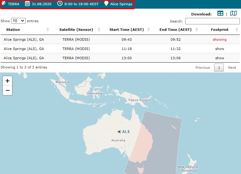
The hotspots displayed on NAFI are detected by satellites that pass across the country in regular orbits, typically producing a few updates every day for a given fire on the ground. To find out when the next satellite pass over an area will be, and when it should get a hotspot update, you can use the link below:

The Daily Satellite Passes site, provided by Geoscience Australia, allows you to view a range of upcoming satellite passes. By selecting a combination of satellite type, date, time and downlink station at top left (red rectangle) and then clicking on the tables entries generated below, you can view the pass areas for these settings on the map. Again, you need to bear in mind there will usually be a 30 minute to 2 hour delay between the satellite detecting a fire and the hotspot appearing on NAFI.


It can be useful to refer to the frequently-asked questions of the data used by NAFI here