SavBAT 2 FAQS - Uploading maps and boundaries
|
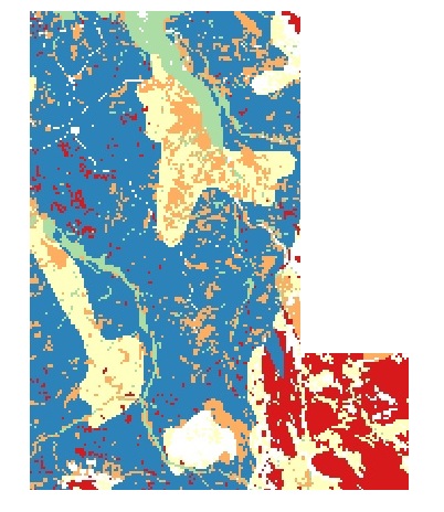
What maps can I upload to SavBAT 2.1? To produce an official Offsets Report, SavBAT 2.1 needs a validated vegetation fuel types map of your project area to calculate the emissions abated. A validated map is one that has been checked with surveys of the project area to make sure the map is accurate. This map together with the fire scar maps from NAFI tells SavBAT 2.1 what vegetation fuels are being burnt. An offsets report will not be accepted by the Clean Energy Regulator unless a validated vegetation fuel types map is used. To produce a hypothetical abatement forecast, you can upload a validated or non-validated vegetation fuel types map or a simple boundary of your project area. Forecasts can be very useful for planning. The "Select File" button allows you to select a vegetation fuel type map or boundary file from your own computer or device - but not from a location on the internet. If you are uploading a vegetation map, it must be stored as an un-zipped geo-referenced tif file and will have the different vegetation fuel classes in the project area mapped out something like this:
It may not be displayed in colour like this, what's more important is that the pixels in the image are formatted and labelled
correctly for the eligible and ineligible vegetation fuel types. It must also have a number of other properties - for example, it
must use a 250m x 250m grid and it must have an Australian Albers equal area projection. |
|||
|
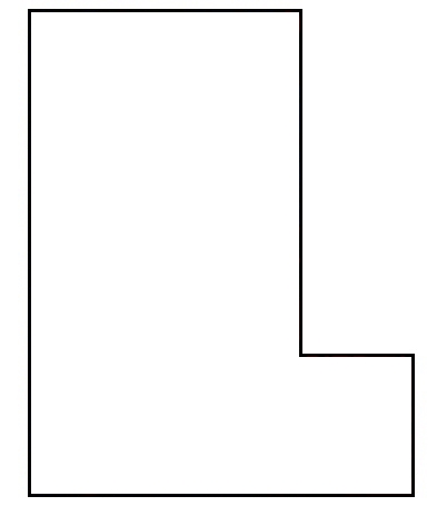 This boundary must be: - EITHER a zipped shapefile (that includes.shp,.prj,.shx and .dbf files) and that must be projected in either GDA 94 geographics or in GDA 94 Australian Albers.
- OR it can be a kml or zipped kml (kmz) file (The files used by Google Earth)
SavBAT 2.1 will then use a government-supplied basemap of the vegetation fuel types which will be clipped to this boundary. This basemap
is not validated and is intended to be used for abatement forecasts. While you can generate offset reports using this map, these
reports cannot be submitted as part of the Savanna Burning Methodology. |
|||