Collecting Field Data
|
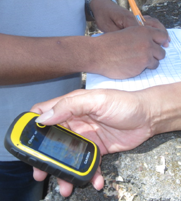
Whilst most mobile devices now have an in-built GPS (Global Positioning System)receiver, it is still very common to use a specialised GPS device in the field. The main reasons for using a dedicated GPS instead of a phone or tablet is that they are generally more robust and built for field conditions, the batteries last longer and can be easily replaced in the field, and finally they are generally easier to use than GPS apps. Mobile GPS apps such as PDF maps or CyberTracker™ however do have the advantage of being able to display custom maps and support the setup of data collection forms. This can be very useful if collecting a lot of information about locations in the field. Whilst the form and function are quite different, both dedicated GPS's and other mobile devices use the same technology for receiving location data from satellites. The following is a brief introduction to GPS technology and its application in the field. For this course we will be focusing on the use of a standard dedicated GPS device. 1. How does GPS work?
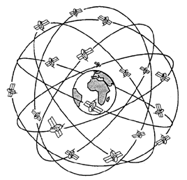
The Global Positioing System used in Australia was developed by the US Department of Defense as a navigation system for military and, later, for civilian use. It is based
on a constellation of 31 Satellites, which orbit the Earth at a height of around 20,000 km and have an orbit period of around 12 hours so that the satellites pass over
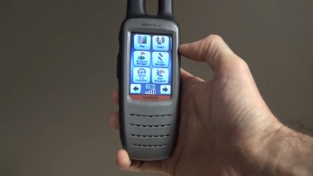
approximately the same location at the sma etime of day. 2. Using a GPS Most GPS have the following menu items:
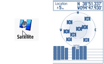
The satellite item will take you to a page showing the satellite the GPS receiver is getting signal from, the signal strength and your location when a position fix is obtained. You can go to this page if you want to know your current location - if, for example, you need to tell someone where you currently located. Location information will generally be displayed in Geographic coordinates, or latitude and longitude. However you can change this to eastings and northings (UTM) format in the settings menu.
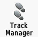
A track is a record of where you have been with your GPS when it has signal. This can be used, for example, to record your aerial incendiary runs, which can be used to show what country you burnt. Tracks of burning activity can be useful to include in reports showing your work, and also to provide to the people conducting the fire mapping so they know where to look. The track manager allows you to view and save tracks of where you have been. It is important when starting a new journey, or new part of a journey; to first save the current track then clear the track. This means the track is saved to the GPS but and you will start a new track. This will make it easier to manage later on.
Waypoints are location points that you can mark at any time in the field. Most GPS have a button on the front of the device that allows you to quickly 'mark a waypoint'. Waypoints can be useful for saving a location where there is something that you want to map later and/or let other people know about. It might a the location of some burnt infrastructure (a fence), a tree over a road, the location of a camp, a good landing site for a helicopter, the location of a patch of weeds etc. When you mark a waypoint it is also possible to give it a name describing something about that point. You can also take a hard copy paper form on which you can write the way point number and attribute information. Software tools such as PDF-Maps and CyberTracker™ help with collecting data in the field by allowing users to fill in on-screen attribute forms which are linked to the waypoint location. 3. Garmin GPS video tutorials
Xavier Espiau, from Land & Sea IT Systems at the Northern Land Council, has produced a number of Garmin GPS video tutorials. To view these tutorials, use the link below: |