NAFI on Google Earth
|
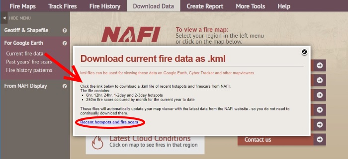
You can view the NAFI fire scars in Google Earth - which can be useful for displaying with other map information. First go to the "Download Data" tab above the map, and then the "Download as .kml" menu on the left. Downloading the NAFI fire scars and hotpots as kml files will allow them to be displayed on Google Earth.
You can choose from "Current fire data" (the recent fires scars and hotspots); "Past year's fire scars" (annual fire scars for each year from 2000); and "Fire history patterns" (fire frequency and time since burnt patterns). You can download the current fire scars and hotpots as shown above - click on the "Recent hotspots and fire scars" link at the bottom of the box that appears. This will download a kml file.
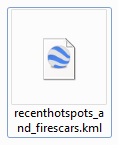
If you already have Google Earth installed just double-click on the kml file and it will open in Google Earth. If you haven't installed Google Earth, it can be downloaded for free from www.google.com/earth/. You can also install Google Earth Pro on a desktop computer for free. The Pro version has extra tools that, for example, allow you to import and display shape files.
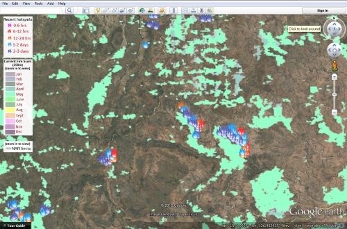
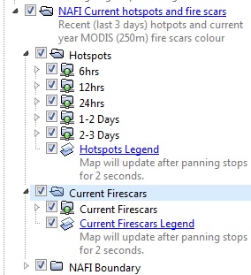
You can tweak the display on Google Earth by using the left hand menu (above) and expanding it by clicking on the little arrows. The hotspot dsiplay shows all recent hotspots up to 3 days old, but you can change this by un-ticking the hotpots you don't want to display. The display of fire scars won't activate until you are zoomed in on the map. If you are not zoomed in enough the samll circle on the "Current Firescars" folder in the menu will still be red. |